
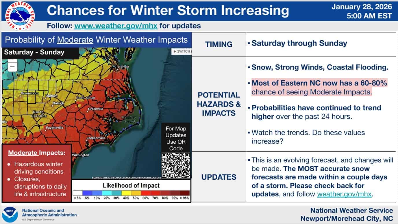
Outer Banks: SnOBX Storm 1-31 to 2-1-26
Increasing confidence for a significant snowstorm for the OBX this weekend
The current forecast for this weekend shows a powerful coastal low setting up over the Outer Banks starting late Friday night through Monday morning. This storm is predicted to bring blizzard like conditions to the Outer Banks with heavy snow (6-10in) and winds of 40-60mph, and ocean overwash on Hatteras Island. This will impact the entire area, and travel is not advised during this event. Moderate to severe beach erosion, and ocean over wash especially on Hatteras Island. Make sure you property is ready for this rare weather event. Please stay up to date as the forecast can change and for traffic conditions if traveling to the Outer Banks and Hatteras Island over the weekend into next week.
Monitor Dare County Emergency Management and Currituck County Emergency Services for real-time alerts.


Leave A Comment
You must be logged in to post a comment.