
Update-Outer Banks: SnOBX Storm 1-31 to 2-1-26
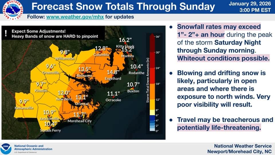
The weather experts are calling what could be an “Historic” snowstorm for the OBX this weekend
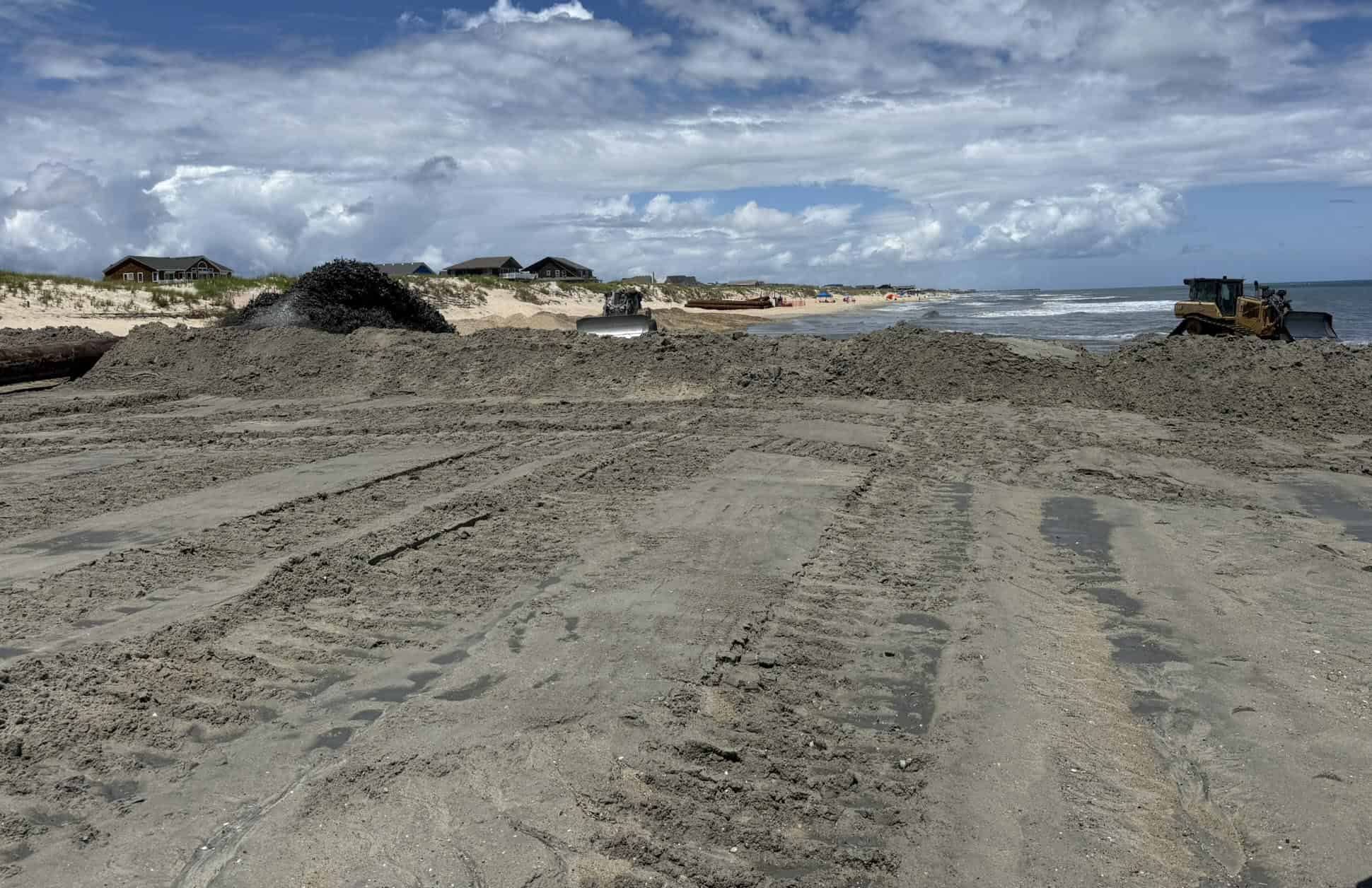
The current forecast for this weekend shows a powerful coastal low setting up over the Outer Banks starting late Friday night through Monday morning. This storm is predicted to bring blizzard like conditions to the Outer Banks with heavy snow up to 12-16 inches and winds of 50-70mph, and heavy ocean over wash on Hatteras Island. Widespread power outages and dangerously cold temperatures will also be a factor. Travel is NOT advised during this event and for several days after. Moderate to severe beach erosion, and ocean over wash especially on Hatteras Island. HYW 12 on Hatteras Island will most likely be closed for an extended period of time. Please stay up to date as the forecast can change and for traffic conditions if traveling to the Outer Banks and Hatteras Island over the weekend into next week.
Monitor Dare County Emergency Management and Currituck County Emergency Services for real-time alerts.


Leave A Comment
You must be logged in to post a comment.